Ridge soaring is perhaps the simplest soaring lift method to understand. If the ambient wind strikes a perpendicular obstacle (like a ridge line), the air has no choice but to go… up.
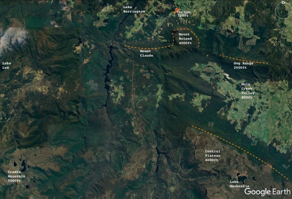
The 4000 foot Mount Roland, right beside the airfield, works really well for ridge soaring. The mountain is almost square, with sheer faces on the west, north and east sides. You can see this shape clearly on this Google Earth image of the local area:
(orange dotted lines show soarable ridge faces)
Annotated Google Earth image showing relevant features for soaring pilots
I’ve done a lot of ridge soaring on Mount Roland and on the ridge line extending immediately to the west, toward Mount Claude. However, until Day Three of this particular three day soaring exercise, I had never been over to the eastern ridge line – the Gog Range.
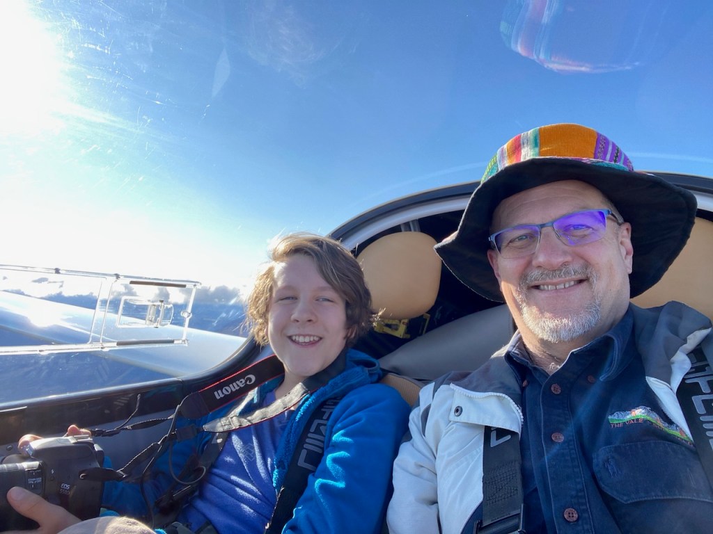
I took off and motored up in the Pipistrel Taurus Electro above the Gog Ranges, shut down the engine, and wafted down to the ridge line to give it a shot.
The wind was in the right direction but wasn’t very strong, so I couldn’t get much above ridge-top height, but I had no problems in maintaining that height, while flying end to end along the Gog Ranges ‘at will’, with an armchair view, watching the world go by 🙂
After a few passes back and forth along the full length of the ridge, I recorded a short video of the experience:
The beeping sound in the video is the sound of the “Audio Vario”. It is a good sound to hear when gliding.
The Audio Vario is a standard piece of gliding instrumentation that converts aircraft rate-of-climb into a tone sequence that becomes more urgent/higher pitched as the climb rate increases. The tone falls away entirely when you are not in lift. This sound lets a soaring pilot keep their eyes outside the cockpit, while using their ears to gauge their soaring performance.
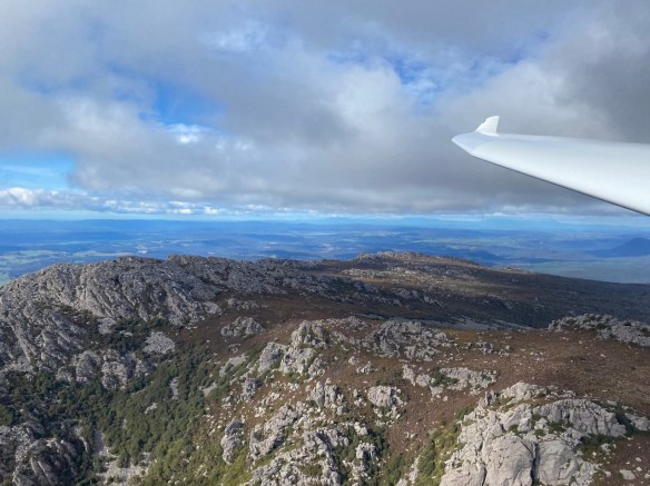
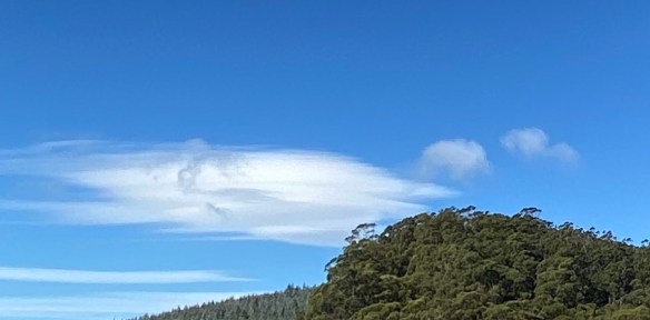
The Gog Range is around 2500 feet high, and the terrain and the forest are really quite pretty. Ridge soaring really allows the opportunity to see it all ‘up close and personal’.
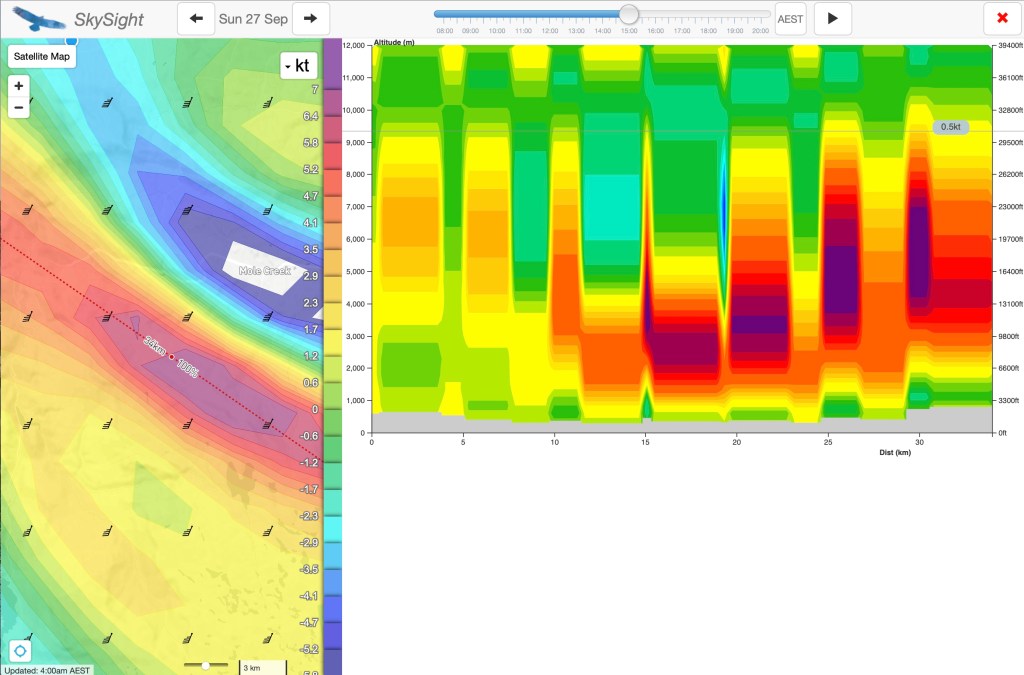
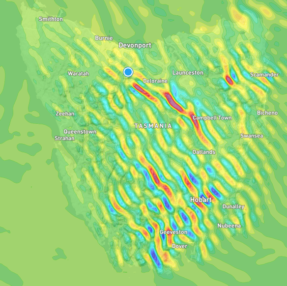
Interestingly, the Skysight ridge lift prediction (below) didn’t highlight the Gog Range, but it did show good ridge conditions on the edge of the Central Plateau itself – parallel and to the south of the Gog Range. It was that prediction that gave me the impetus to try the nearer, smaller Gog Range line.
The Central Plateau is a much higher, much more sheer, face – but it is also somewhat further away (with a long motor run back into wind to get home from it). That is something to try on another day.
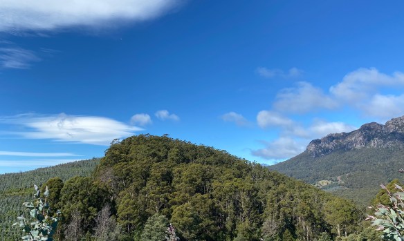
Here is how the ridge looked, from the far (eastern) end, looking back toward Mount Roland in the distance:
First visit to the Gog Range in ridge conditions
Skysight Ridge Lift Prediction
This ridge flight in the Taurus Electro capped off three excellent days, experiencing three different weather systems and three different sorts of soaring technique, all in the same place.
Thermals are columns of rising hot air, driven by the sun differentially heating the ground. When there is sufficient moisture in the atmosphere, that rising air condenses at the top of the thermal to form a Cumulous cloud (or ‘Cu’).
Cumulous clouds are the classic fluffy white clouds often seen on a sunny day. These clouds showing a glider pilot the top of where a thermal is (or where it was – the lift under them tends to ‘cycle’ on and off over time).
Thermals can exist whether the Cu clouds are there as indicators of it or not. The gliding term for the Cu cloud right above you is a “Near Cu”. The term for the even better looking Cu Cloud that is just too far away to reach is a “Far Cu”.
Covering ground on a Thermal day involves circling slowly and tightly in the core of the rising air, gaining height, until the thermal starts to weaken. Then it is time to set sail for your intended destination, optimising your cruising performance by slowing down in lift and speeding up in ‘sink’ (a technique called ‘Dolphin Soaring’). If you get low again, it is time to find another thermal.
Australia is a great place to fly gliders in general. In the arid areas of the mainland it is possible to achieve quite spectacular soaring distances in the middle of summer. How far can you go? Just take a look at the current Australian Distance Records.
Back in Tasmania, on Day Two of Three, the wind had moderated and the day was several degrees warmer. The Skysight weather model indicated that there would be thermals in the middle of the day rising to 5500 feet or so, which is easily high enough to have a very fine time going gliding.
We set off in the Pipistrel Taurus Electro to explore those thermals and found that they were big, wide and gentle (not always the case!), and that the intermediate sink zones were also quite moderate.
Gabe and I wound up reaching around 6000 feet (very much in accordance with the prediction) over the very same valley that we had wave soared across the day before. The snow on the Central Plateau from the previous day had already started to melt.
We had a lovely time of it, just wafting about the neighbourhood, and the living was easy. Indeed, as is often the case on a good thermalling day – by late in the afternoon it seemed hard to go down 🙂
Here are some pictures from Day Two:
Mount Roland from just above the summit
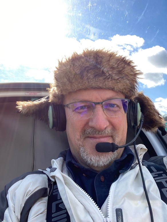
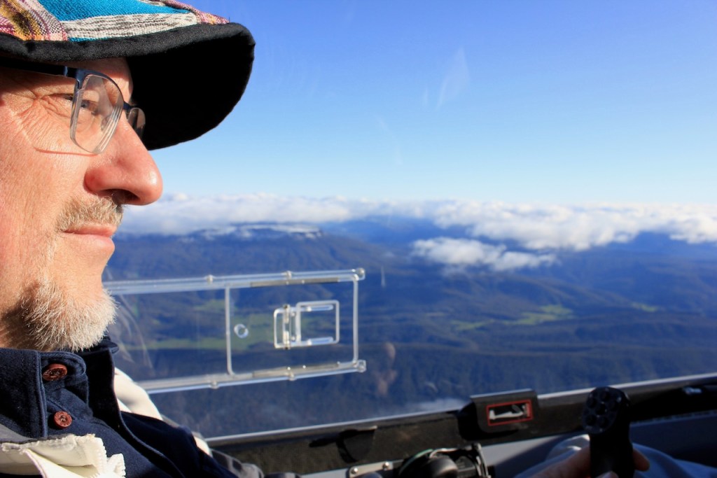
High Altitude Headgear
Mount Roland looks dramatic from any angle
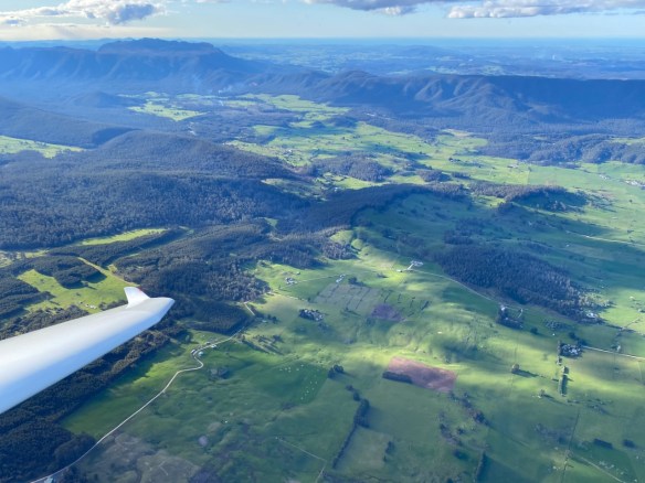
Near Mole Creek with Mt Roland (left) and Gog Range (right) in the distance
The Vale Airfield
Skysight Thermal Model
Going in Circles: Thermals to 6000 feet
In the next post – on day three – I had a chance to use yet another soaring technique – Ridge Soaring.
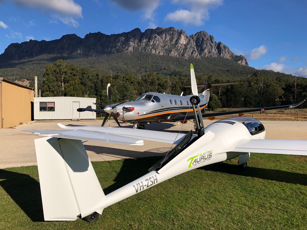
The Vale Airfield is a 1300m grass runway running parallel to the Dasher River in NorthWest Tasmania. It is situated only a couple of nautical miles from a beautiful mountain, Mount Roland.
This 4000ft granite beast dominates the local view all the way to the nearby town of Sheffield. It is part of a system of ridge systems that give way to the Tasmanian Central Plateau. The Plateau is a large, gorgeous and pristine alpine and lake region that includes the world famous Cradle Mountain national park.
Over the last several months, I’ve been using Pipistrel Taurus G2 electric self-launch motor glider to gradually (and carefully) explore this complex, fascinating, and beautiful area from the air, through a variety of weather conditions. The conclusion I’ve reached is that we are fortunate indeed, to have an airfield that is surely one of the best places in Tasmania to fly gliders.
There are many opportunities to go soaring here, using a wide variety of ‘lift’ mechanisms enabled by this fascinating and complex terrain – and to do it all year round!
What follows is a study in the successful use of the three major ways to sustain soaring flight in gliders, in flights were conducted over three successive days at The Vale, in three distinct weather systems.
Lets start with an annotated Google Earth image of the local area from the point of view of a soaring pilot (click image to enlarge) and then we’ll turn to Day One:
(The orange dotted lines are some of the local area ridge lines)
Many opportunities for soaring flight are driven by this complex geology
Day One: Mountain Lee Wave Soaring
One of the most wonderful ways to go soaring in a glider is the use of ‘Mountain Lee Waves’.
Wave (in this context) refers to a large standing-wave that forms in the atmosphere downstream (to the Lee) of a large physical feature (such as a mountain) in the presence of a strong and consistent wind that increases in strength with increasing height.
Mountain waves can extend into the sky to heights that are multiples of the height of the ground feature that triggers them. What forms in the air is an ‘echo’ of the shape of the ground feature, high up in the sky, with the into-wind side being a tide of rising air that can be surfed in a glider, to gain height.
Even better: If the wind keeps getting stronger with height, the primary wave system can act like another mountain! One wave can trigger another wave system, located further downwind and higher than the primary wave. This can keep happening, with multiple wave systems capable of ‘stacking up’ in a rising sequence.
Clouds can form in the middle of a wave system, appearing in a classic “Lenticular” shape, being quite literally ‘polished’ by the air rotating around the wave core. In the presence of multiple secondary waves, there can be a ‘stack’ of these lenticular clouds.
On the day we flew, there were no lenticular clouds to indicate the presence of the wave system… it was still there, but it was invisible.
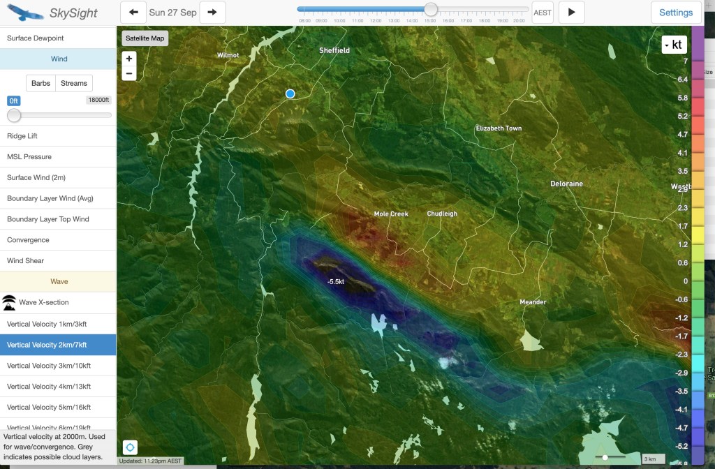
However, I had another way to find the wave. I used a fabulous soaring pilots’ weather prediction application called Skysight.
Skysight has access to global, high accuracy weather forecasting data and it uses this data and a great deal of smart number-crunching to generate predictive, visual, forecasts for glider pilots. These forecasts help them to predict (with high accuracy in both space and time) the presence of various distinct sorts of weather systems that can be used to sustain soaring flight.
You can explore these images (generated by Skysight) to see what I mean:
The Skysight model for wave showed multiple significant wave zones at increasing heights
The primary wave prediction for 7000kt shows lift over the with a zone of sink beyond it, pver the central plateau edge
At 23000ft, the Skysight wave model shows the large secondary wave system positioned further south, over the central plateau
This image shows just how close the The Vale is to multiple nearby wave systems.
As per those images, the Skysight model showed the presence of a substantial primary wave system above 5000 feet, then extending through multiple secondary wave systems all the way up to over 20,000 feet (!).
It turns out that this wave system sets up quite frequently in Tasmania in the cooler months.
An impressive example of this happened back on 12th April 2020. This was not a day that I could fly (darn). Have a look (below) at just how impressive the wave system was, right across Tasmania. Lennies very much in evidence in the sky to go with it. A soaring pilot could have hopped from wave to wave, literally across the entire state.
Stacked Lenticular Clouds over Mole Creek
Stacked Lenticular Clouds (detail)
Wave over Mole Creek
Wave in the Vicinity of The Vale
Wave over the whole of Tasmania
Back to the present – and with my son Gabe as our photographer and co-pilot, it was time to see if the computer model was accurate in telling us that the wave was there, even though the indicator clouds were not.
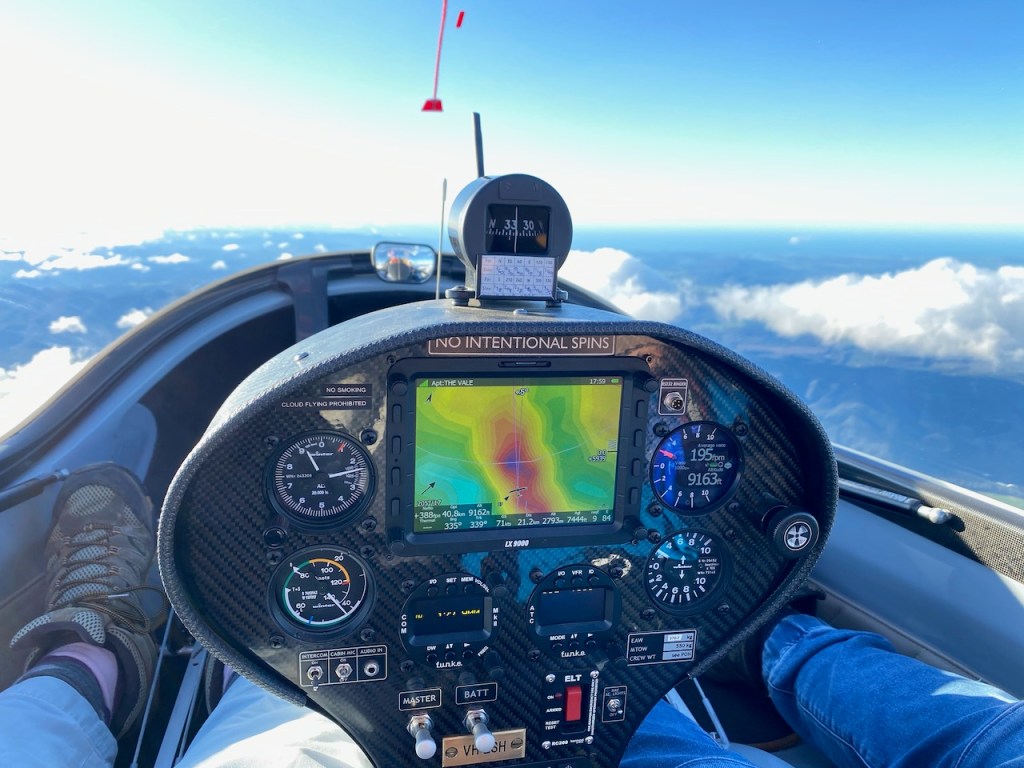
To help us to find this quite invisible lift system, it was time to engage another piece of technology, the LX9000 soaring glass-cockpit system in my glider. The LX9000 is an incredible instrument. One of its plethora of features is the ability to import Skysight predictive map overlays directly onto the device for display in flight.
This means that I could fly the glider with the wave predictive model ‘on screen’, so we could fly under power up to the height and position needed to contact the wave system, and then shut down the motor and start playing.
We did precisely this. We climbed to about 5000 feet and flew to the edge of the predicted lift zone, and shut down the engine. As if by magic – there it was, and we just starting going up.
Here’s what the Skysight wave overlay looks like in the LX, in flight, in the aircraft. On the image, the lift zone is the yellow/orange/red zone on the map.
This photo was taken at a later point, when we had already climbed in wave up to over 9000 feet:
Successfully working the primary wave system with the Skysight predictive model overlaid on the LX9000
Wave lift is wonderful – it is a smooth, quiet journey of exploration, quietly working your way back and forth along the lift band.
Being a system driven entirely by wind, wave conditions can be (and mostly are) present in the depths of winter, when flat-land glider pilots have given up gliding for the season due to the lack of any useable thermals.
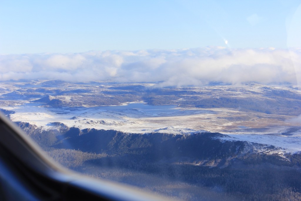
We flew the glider up and down the Mole Creek Valley on our climb, and wound up high over the edge of the Central Plateau. The Plateau was covered in a layer of snow from the previous night, and it looked rugged and wonderful.
Here’s are some images from the wave flight:
Batteries fully charged and ready to go
Wave soaring expedition underway
Successfully working the primary wave system with the Skysight predictive model overlaid on the LX9000
The high country with recent snowfall around Lake MacKenzie
Central Plateau shrouded in snow
Wave soaring in clear air, above the clouds
Author after a successful wave flight
The Central Plateau rises beyond the Mole Creek Valley
The Taurus Electric Drive System is visible in the mirror
The central plateau features rugged terrain high above forest valleys
Soaring above the clouds in the sunshine
Heading back toward Mount Roland from Mole Creek
Central Plateau Cliffs
(Photo credit for many of these images: Gabe Hackett)
The next post will be about Day Two of Three when the wind moderated, the sun came out, and the lift was there again – but this time it was Thermals.
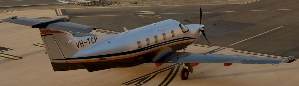
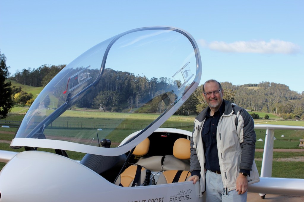
I am fortunate to own the first electric self-launch glider to fly under Australian skies. It is a Pipistrel Taurus Electro G2.
Pipistrel Taurus Electro G2 at The Vale
A few months ago, I wrote a story that explained the background and my journey to owning and flying this impressive little aircraft. The story was published in the Gliding Federation of Australia’s Gliding Australia magazine.
I’m posting these links as a precursor/background to a story I will write soon about three wonderful days of flying this aircraft from our airstrip in Tasmania.


You must be logged in to post a comment.